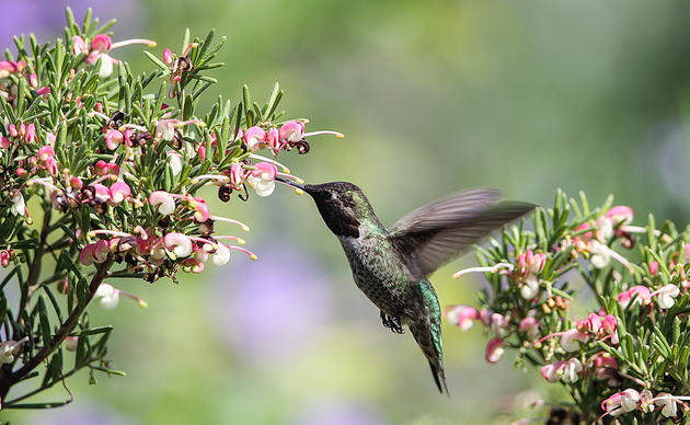
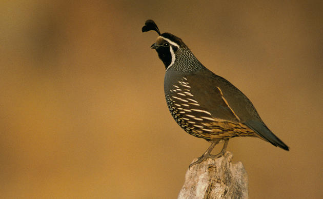
With its dramatic coastlines, lush forests, blooming valleys, and vivid deserts, California’s spectacular natural landscapes host the largest, most diverse concentration of birds in the United States.
Scattered across this geography are 149 Important Bird Areas that provide more than 10 million acres of essential habitat for breeding, wintering, and migrating birds. We must protect these sites to ensure the survival of our state’s rich array of birds.
Audubon California has used the best science to identify and map these Important Bird Areas. Part of an international effort, these sites were nominated by local experts and selected according to strict criteria:
- Support over 1% of the global or 10% of the state population of one or more sensitive species
- Support more than nine sensitive bird species
- 10,000 or more observable shorebirds in one day
- 5,000 or more observable waterfowl in one day
This section of our website contains links to maps, site descriptions, and other information related to California’s Important Bird Areas. We encourage you to look around and learn more.
To learn more about Important Bird Areas in California, explore our interactive map.
To nominate a new Important Bird Area, please email us with a brief description of your proposed site and location (click on the map to determine if area is already an IBA). A site will need to meet at least one of the criteria above and have data from within the past 10 years, and for more than 1 year. If your site fits this description, we will send you a nomination form and instructions.
Monitoring IBAs and Impacts of Global Warming
National Audubon Society scientists recently released a study (http://climate.audubon.org/) on the impacts to North American birds from climate change based on Christmas Bird Count and Breeding Bird Survey data. Audubon CA conducted additional analysis to determine which IBAs in California are likely to provide the most suitable conditions for birds to thrive in the future. Below is a map and list of the predicted “top 50” most climatically suitable IBAs.
How You Can Help!
You can help us by gathering data on birds at these (or other) sites! Citizen Science data was used to generate our research and is essential in the future for helping us understand everything from bird distribution, timing of breeding, timing of arrival from wintering grounds, length of stay, etc. With your help we can learn more about how birds respond and create management and conservation programs to help protect these important areas. Click here to see a list of the 170 species that are climate threatened or endangered in California.
TYPES OF SURVEYS:
- http://ebird.org/content/ca/ Contribute data to eBird! Date from eBird is accessible to Audubon scientists and is associated with IBAs. Consider picking an IBA from the list below and doing a complete survey and entering your results here.
- http://birds.audubon.org/christmas-bird-count Participate in a Christmas Bird Count! Find a count near you or consider creating your own new count in an uncovered area.
- http://www.hummingbirdsathome.org/ Audubon’s Hummingbirds at Home project helps us learn about climate endangered Hummingbirds such as Allen’s Hummingbirds – where they are located and how they respond to flowering plants.
- https://www.pwrc.usgs.gov/bbS/ Participate in a Breeding Bird Survey, or start a new, or pick up a vacant, route.
- http://data.prbo.org/apps/pfss/index.php?page=volunteer Point Blue’s Pacific Flyway Shorebird Survey is a great way to monitor shorebirds at your local estuary, beach, or inland wetland refuge. Counts take place mid November – mid December.
If you have any questions or need help setting up a monitoring program, please contact ajones@audubon.org.
Thank you in advance for your help in monitoring California’s birds!
About the Map
National Audubon Society scientists have integrated the climate change projections into spatial prioritizations. These prioritizations highlight areas on the landscape that are likely to offer suitable climates for a single species or multiple species today and into the future. They can be used to strengthen the justification for projects already underway as well as to identify new areas in need of conservation attention.
Specifically, the prioritizations provide the relative rank of locations across the landscape. Here, we’ve used the prioritization rankings for the 314 climate threatened and endangered species across both seasons. With this data, we’ve calculated the average ranking of each IBA in California. The 50 highest ranking IBAs in California are shown above in orange.
Top 50 Climate Refugia Important Bird Areas in California
- Alameda Naval Air Station
- Ano Nuevo Area
- Ballona Valley
- Big Sur Area
- Big Valley/Ash Creek
- Bodega Harbor
- Bolinas Lagoon
- Butte Valley
- Camp Pendleton
- Cape Mendocino Grasslands
- Carmel River/Point Lobos
- Concord Marshes
- Corte Madera Marsh
- Eagle lake
- Eastshore Wetlands
- Elephant Tree Forest
- Elkhorn Slough
- Goleta Coast
- Imperial Valley
- Klamath Basin/Clear Lake
- Lake Casitas Area
- Lopez Lake Area
- Lower Los Angeles River
- Mission Bay
- Morro Bay
- North San Diego Lagoons
- Orange Coast Wetlands
- Pt. Mugu Area
- Puente-Chino Hills
- Richardson Bay
- Salinas River - Lower
- Salinas River - Middle
- Salton Sea
- San Antonio Valley
- San Diego Bay
- San Diego NWR-East
- San Francisco Bay - South
- San Joaquin Hills
- San Pasqual Valley
- Santa Ana River Valley
- Santa Lucia Peaks
- Santa Margarita Valley
- Santa Maria River Valley
- Santa Ynez River Valley
- Southern Orange County
- Terminal Island Tern Colony
- Tijuana River Reserve
- Tomales Bay
- Vandenberg AFB
Monthly Giving
Our monthly giving program offers the peace of mind that you’re doing your part every day.
How you can help, right now
Get Audubon CA in Your Inbox
Our newsletter is fun way to get our latest stories and important conservation updates from across the state.

Donate to Audubon
Help secure the future for birds at risk from climate change, habitat loss and other threats. Your support will power our science, education, advocacy and on-the-ground conservation efforts.
HOTSPOT: Flyover of California's Birds and Biodiversity
California is a global biodiversity hotspots, with one of the greatest concentrations of living species on Earth.