Tricolored Blackbird
Latin: Agelaius tricolor
Partnering with landowners to protect birds
Black-necked Stilt flying by granary.
Audubon California's Working Lands Program increases the scope and scale of bird-friendly practices on farms, wetlands and other managed lands in the Central Valley. We do this by cultivating relationships with landowners, advocating for statewide policies that secure water and habitat for birds, and engaging our grassroots network in their communities. Our work provides protection for focal species like the Long-billed Curlew, Tricolored Blackbird, and Western Grebe.
California’s Central Valley has 205,000 acres of managed wetlands, less than 5 percent of what was historically available. The region has some of the most fertile land in the nation and boasts 7 million acres of irrigated farmland. Some types of farms – particularly those with rice and other flood-irrigated field crops – provide important and complimentary habitat to managed wetlands for birds and other wildlife. This synergy of flooded farmland and managed wetlands fundamentally links the health of Pacific Flyway bird populations and California’s farms. Audubon California has worked for 15 years to build partnerships with farmers to protect, enhance, and restore bird habitat on farmland in California’s Central Valley.
The Pacific Flyway, connecting Alaska and South America, is a major migratory pathway for birds. The Central Valley is an important stopover site for birds to feed and rest. Flooded habitat provided by Central Valley farms, refuges, and other managed areas supports between 5-7 million waterfowl and 350,000 shorebirds each year- that’s over 60% of the Pacific Flyway and 20% of the nation's waterfowl population! Over the long-term, the best opportunities to ensure the long-term conservation of birds and other wildlife in the Central Valley are to protect and enhance working landscapes for birds and wildlife while also ensuring a vibrant system of managed wetlands on public and private lands.
Examples of Audubon California's private lands work includes:
The Tricolored Blackbird in California
Grasslands Video on CVPIA with MH from Meghan Hertel on Vimeo.
How we empower ranchers and consumers to protect grassland birds.
An innovative partnership to save California’s vulnerable birds
From fires in the Sierra to clouds of windblown dust at the Salton Sea, the effects of drought driven by climate change are impossible to ignore.
California supports a large population of wintering Sandhill Cranes in its Central Valley and northeastern corner.

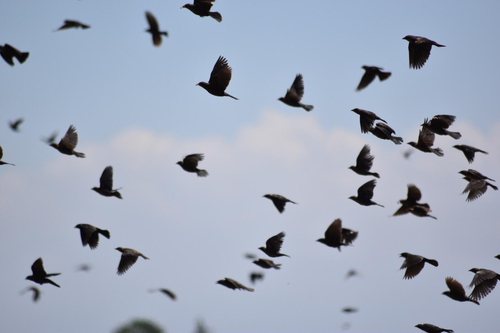
Despite small breeding colonies in neighboring states, Tricolored Blackbirds are California's blackbird. Over 95 percent of the global population resides in the state. While anyone ever seeing a teeming flock of “trikes” feeding or in flight might have a hard time believing, the bird was listed as threatened under the California Endangered Species Act in 2019. However, Audubon research indicates that populations may be beginning to recover.
As recently as 1930, millions of Tricolored Blackbirds darkened the skies near Central Valley wetlands. As marshes were drained, the birds moved onto agricultural land, especially wheat fields. Farmers typically harvest their crop before nestlings have fledged, even wiping out the young of entire colonies in a single day as harvesting machinery moves across an occupied field. In surveys conducted from 2005 through 2009, less than half of colonies escaped destruction of their nesting areas.
For the past eight years, Audubon has worked together with farmers, the California Department of Fish and Wildlife, Natural Resources Conservation Service and other partner organizations to locate colonies and encourage growers, through financial incentives, to postpone harvests until nestlings had fledged. In a study recently published in the journal Western Field Ornithologists, we found that this public-private partnership has been highly successful: from 2015 to 2022, nearly 100 percent of nesting attempts on agricultural land were conserved, and the number of birds nesting in grain fields increased by as much as 100,000. The reported increase in the population was confirmed during the most recent stateside survey in 2022. This survey is a coordinated voluntary effort, involving many chapter members across the state, to survey suitable habitat areas for birds resulting in a snapshot in time that tells us approximately how many birds are in the population. Protection of the most at-risk nesting sites is contributing to a bump in Tricolored Blackbird populations statewide, but innovative conservation efforts must be continued if the species is to recover fully.

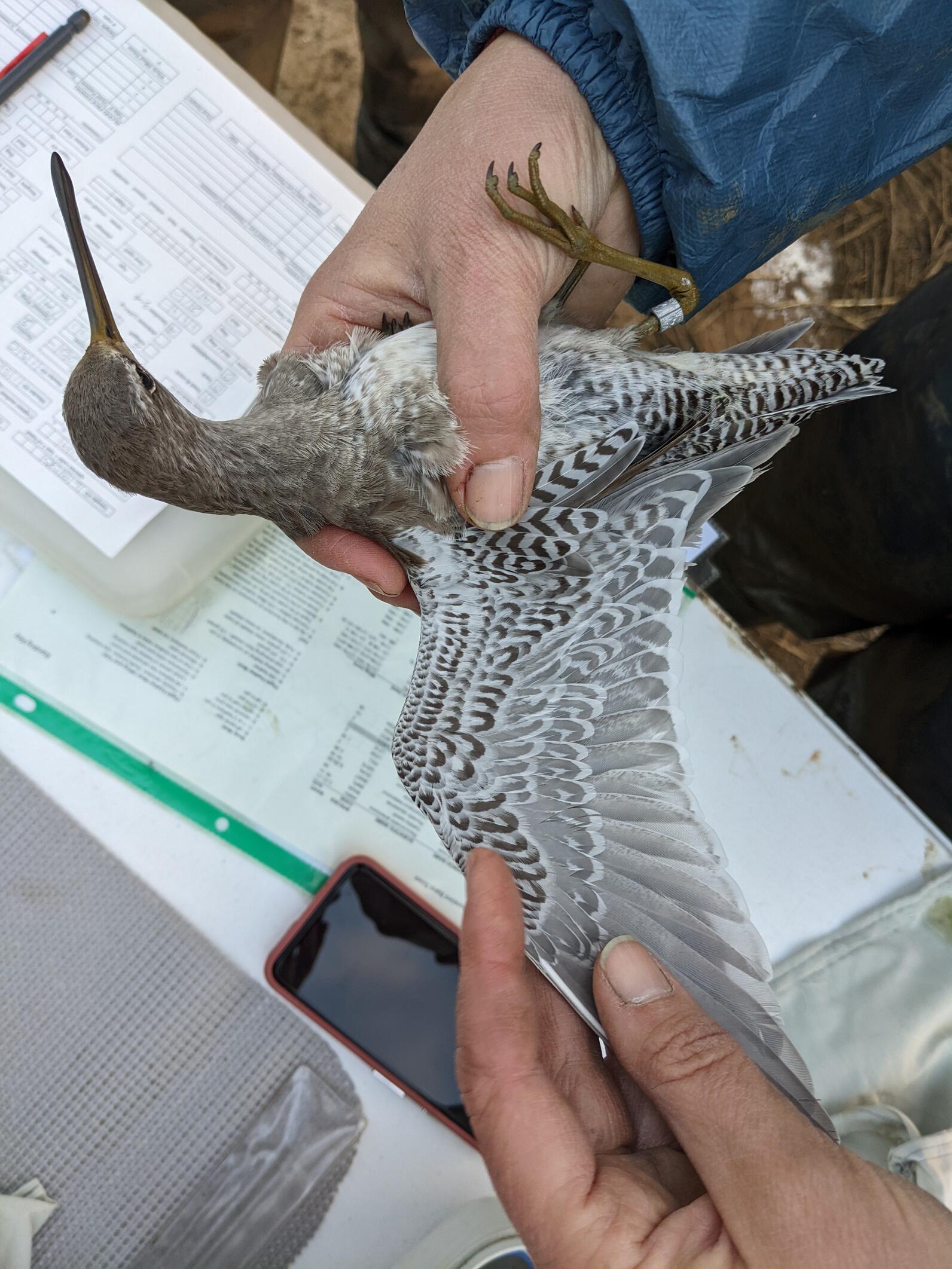
It takes more work than you might think to measure the health of a Long-billed Dowitcher. Not only do you have to be up before dawn, sloshing through muddy rice fields to set up mist nets in the dark, but once the target birds are caught, you have to move fast. You have three minutes to draw a blood sample before stress hormone levels rise, throwing off measurements of their baseline condition.
Prior research suggests Long-billed Dowitcher and other shorebirds are under a lot of stress. According to a landmark 2019 study by the Cornell Lab of Ornithology, shorebird populations have declined steeply over the past 50 years, by more than a third since 1970. Audubon is working with Point Blue Conservation Science and The Nature Conservancy, as part of the Migratory Bird Conservation Partnership to study the impact of years of drought on migratory shorebirds in the Central Valley.
The Central Valley is an ideal place to monitor shorebird populations. This 600-mile-long cleft through California’s center acts as a funnel for a wide range of birds migrating along the Pacific Flyway, including millions of waterfowl and hundreds of thousands of shorebirds, many of which spend the winter in the valley’s temperate climate. This year’s heavy rains notwithstanding, the region has also been hard hit by recent drought, shrinking wetlands at vital wildlife refuges and on private lands. While we don’t know exactly how hard the drought has been on shorebirds, we do know that shorebirds face habitat deficits even in non-drought years, especially in fall and spring, when rice fields and wetlands are largely dry. Audubon works as part of the Migratory Bird Conservation Partnership and many other partners, including the California Department of Fish and Wildlife and the California Rice Commission, to fill this habitat gap facing shorebirds.
While there’s no workaround for predawn hours and muddy slogs through flooded rice fields, newer technology allows us to tag these shorebirds with tiny trackers that communicate with the North American Motus Wildlife Tracking System, a network of receiving towers that get their name from the Latin word for “motion.” This is the same technology that powers Audubon’s Bird Migration Explorer, and it allows us to track where shorebirds are finding habitat… and where they’re not. Another vital piece to understanding drought affects shorebirds is to learn how the birds use existing protected lands at state wildlife areas. In coordination with California Department of Fish and Wildlife staff at state wildlife areas, we are conducting monthly shorebird surveys to understand the contribution of these protected areas to shorebird habitat use.
The study is funded by the California Department of Fish and Wildlife.
Our newsletter is fun way to get our latest stories and important conservation updates from across the state.
Help secure the future for birds at risk from climate change, habitat loss and other threats. Your support will power our science, education, advocacy and on-the-ground conservation efforts.
California is a global biodiversity hotspots, with one of the greatest concentrations of living species on Earth.